Discover the Neighborhoods in the Springfield Community Land Trust
Discover the Neighborhoods in the Springfield Community Land Trust
Our Neighborhoods
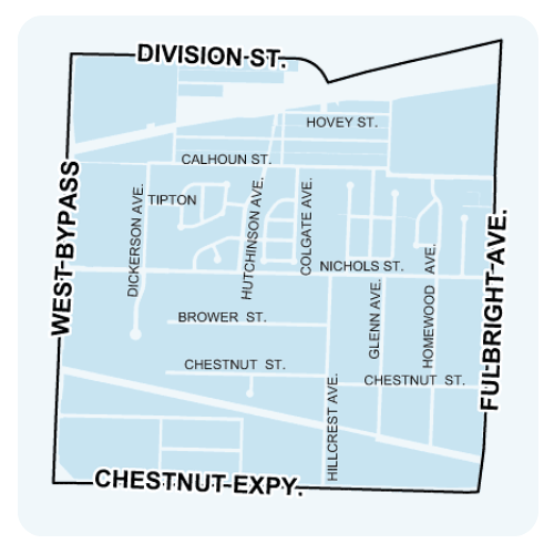
Bissett
Bissett neighborhood is located south of Division Street and east of West Bypass in Springfield, MO.
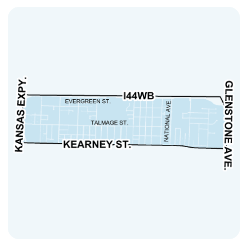
Doling
Doling neighborhood is located south of I-44 and east of Kansas Expressway in Springfield, MO.
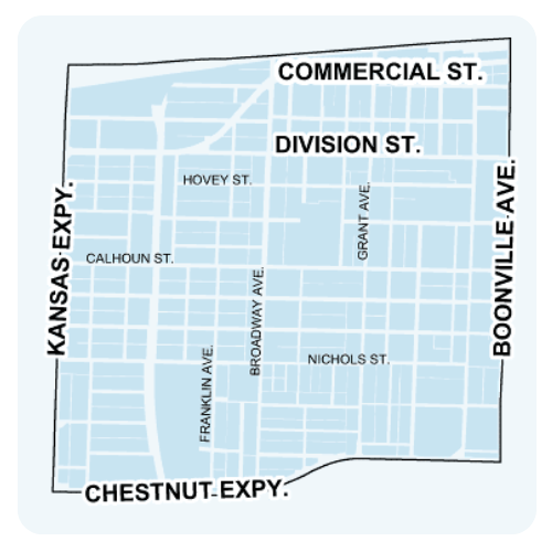
Grant Beach
Grant Beach is located north of Chestnut Expressway and east of Kansas Expressway in Springfield, MO.
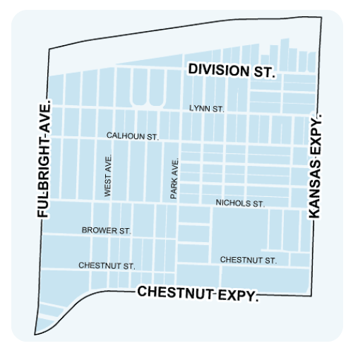
Heart of the Westside
Heart of the Westside is located north of Chestnut Expressway and east of Fulbright Avenue in Springfield, MO.
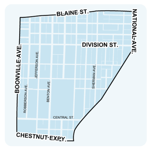
Midtown
Midtown is located south of Blaine Street and east of Boonville Avenue in Springfield, MO.
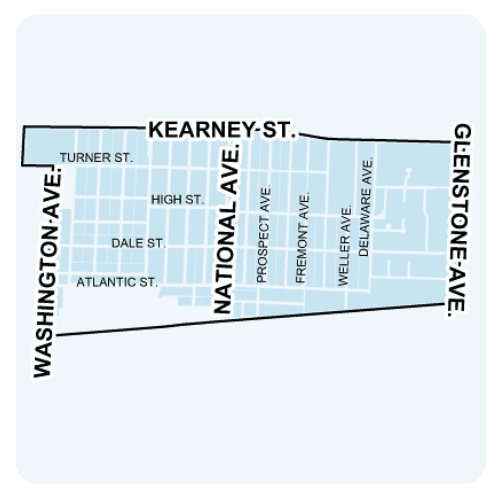
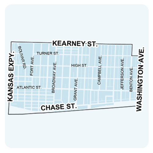
Robberson
Robberson is located south of Kearney Street and east of Washington Avenue in Springfield, MO.
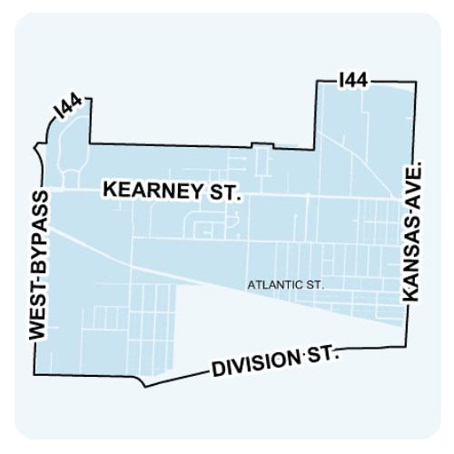
Tom Watkins
Tom Watkins is located north of Division Street and east of West Bypass in Springfield, MO.
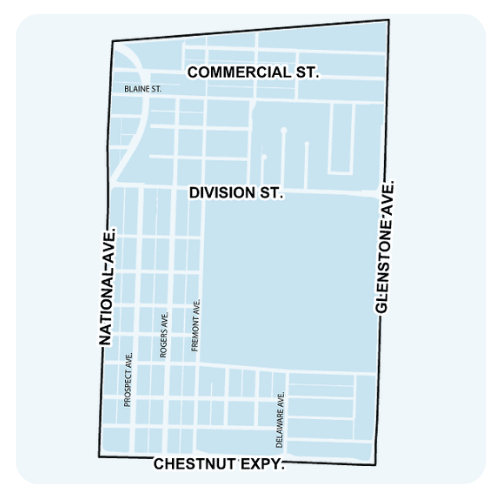
Weller
Weller is located north of Chestnut Expressway and east of National Avenue in Springfield, MO.
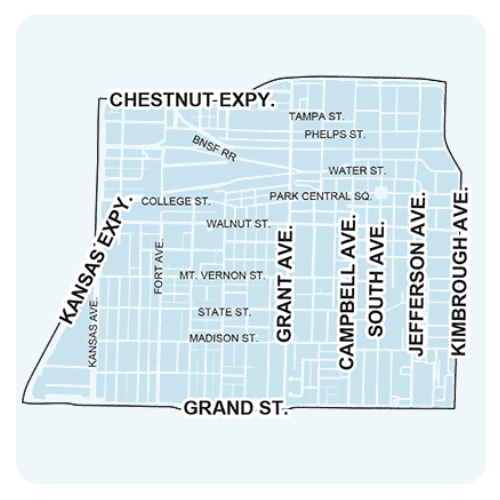
West Central
West Central neighborhood is located south of Chestnut Expressway and east of Kansas Expressway in Springfield, MO.
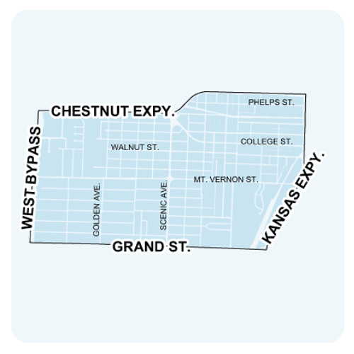
Westside
Westside neighborhood is located south of Chestnut Expressway and east of West Bypass in Springfield, MO.
Woodland Heights
Woodland Heights neighborhood is located south of Kearney Street and east of Kansas Expressway in Springfield, MO.